fact sheet
Type of resources
Keywords
Publication year
Topics
-
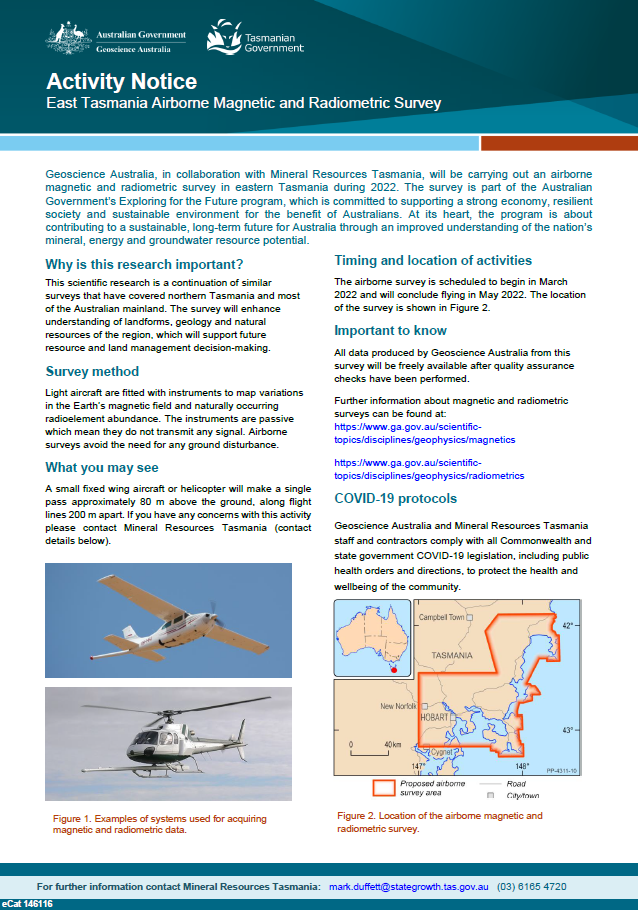
Geoscience Australia, in collaboration with Mineral Resources Tasmania, will be carrying out an airborne magnetic and radiometric survey in eastern Tasmania during 2022. The survey is part of the Australian Government’s Exploring for the Future program, which is committed to supporting a strong economy, resilient society and sustainable environment for the benefit of Australians. At its heart, the program is about contributing to a sustainable, long-term future for Australia through an improved understanding of the nation’s mineral, energy and groundwater resource potential. <p>
-
The Upper Darling Floodplain AEM Survey is part of the Exploring for the Future Program. This scientific research is being carried out to obtain data that will enhance understanding of the groundwater resources of the upper Darling River region. This information will support future water resource management decision-making in the region.
-
The AusArray program aims to install small temporary passive seismic stations every 200 km across Australia. The seismic stations will passively measure small natural vibrations that travel through the Earth to help scientists understand the distribution and composition of rocks beneath the ground. Seismometers are sensitive instruments used to measure small natural vibrations that travel through the Earth caused by earthquakes, waves breaking on the shore and even wind. The data collected are analysed to create a three-dimensional model of the Earth’s subsurface. Passive seismic data can be used to model the Earth‘s structure, which is used to infer the geological history and assess the resource potential and natural hazards of the region.
-
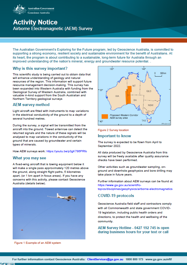
Geoscience Australia, in collaboration with state governments, will be carrying out airborne electromagnetic (AEM) surveys in western South Australia, southern NT and eastern WA during 2022. This scientific research is being carried out to obtain data that will enhance understanding of geology and natural resources of the region. This information will support future resource management decision-making. This survey has been expanded into Western Australia with funding from the Geological Survey of Western Australia, combined with valuable in-kind support from the South Australian and Northern Territory geological surveys. <p>
-
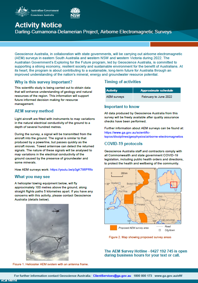
Geoscience Australia, in collaboration with state governments, will be carrying out airborne electromagnetic (AEM) surveys in eastern South Australia and western NSW and Victoria during 2022. The Australian Government’s Exploring for the Future program, led by Geoscience Australia, is committed to supporting a strong economy, resilient society and sustainable environment for the benefit of Australians. At its heart, the program is about contributing to a sustainable, long-term future for Australia through an improved understanding of the nation’s mineral, energy and groundwater resource potential <p>
-
As part of the program, the Darling-Curnamona-Delamerian project is investigating the groundwater potential of the upper Darling River floodplain, as well as the mineral and groundwater potential of parts of eastern South Australia, western New South Wales, western Victoria and western Tasmania. Communities, industries and the environment in the upper Darling River region have been impacted by recent droughts. During periods of low flow in the Darling River, groundwater has the potential to be an alternative water source for towns, agriculture and mining. The aim of the Upper Darling River Floodplain Groundwater study is to identify and better understand groundwater supplies beneath the floodplain and its surrounds. When combined with innovative water storage options, these groundwater resources could provide enhanced drought security and promote regional development. The study area covers ~31,000 km2 and includes a 450 km stretch of the Darling River floodplain from Wilcannia upstream to Bourke and Brewarrina.
-
Geoscience Australia, in collaboration with state government agencies, has been collecting magnetotelluric (MT) data as part of the Australian Lithospheric Architecture Magnetotelluric Project (AusLAMP) for several years. This program aims to map the electrical resistivity of the rock layers, at depths from ten kilometres to hundreds of kilometres, across the entire continent. AusLAMP sites are each about 55 km apart from each other. Locations are chosen in consultation with landholders and other stakeholders to minimise impacts and avoid disturbance.MT data is collected using sensors that record naturally occurring variations of the Earth’s magnetic and electric fields. The equipment does not produce or transmit and signals. After four to six weeks the equipment is retrieved and the site restored to its original condition.